ATV/Four Wheeling
4-wheeling, motorsports, OHV
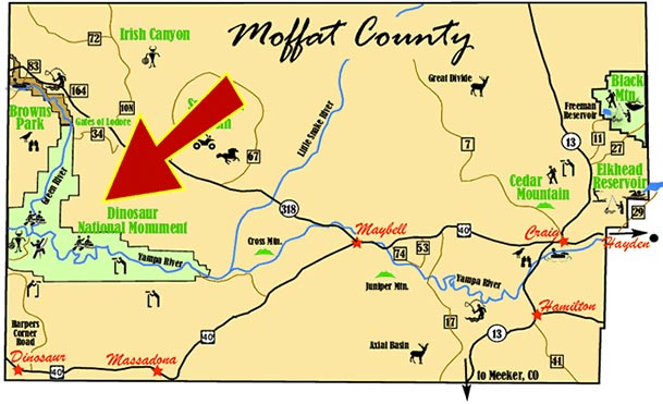
With nearly 2 million acres of public lands and more than 2,000 miles of city and county roads open to all-terrain vehicles, Moffat County should be your destination whether want to use your off-highway vehicle to explore the backcountry or rev up the engine competitively.
Go off road on high desert terrain or though mountain forests. Popular destinations for four-wheel adventures include Black Mountain, Sand Wash Basin, California Park, the Routt National Forest, Elkhead Creek, North Park and more.
Many backcountry county roads provide access to public lands and recreation areas. Areas that are closed to OHV use are posted.
Remember to register your OHV. Registrations for in-state and out-of-state users are available at the Craig Chamber of Commerce & Moffat County Visitor Center or register online.
Moffat County also boasts a groomed track for motocross racing south of town. For more information on motocross racing, call 970.824.5517.
Cross Mountain Canyon
Cross Mountain Canyon Overlook provides a great summertime excursion for a day trip or overnight camping.
To get there: Take U.S. Highway 40 approximately 45 miles from the intersection of Colorado Highways 13 and 40 in Craig to mile marker 44. Turn north on the Deerlodge Park Road. Travel north 2 miles to Moffat CR 123. The road is paved to this point. Turn right (east) onto County Road 123 and follow it a half mile to an unmarked intersection near the top of the ridge. Turn left onto a BLM road and follow about three miles to the trailhead.
A rough unmarked hiking trail leaves to the canyon overlook. Follow the trail downhill through the gate for 50 yards, and then ascend the ridge north, left to the canyon overlook. The hike is about 1/4 mile each way. There are no barriers at the overlook, so watch your step. After you leave the pavement, the road is rocky in spots. A pickup or SUV with good tires is recommended.
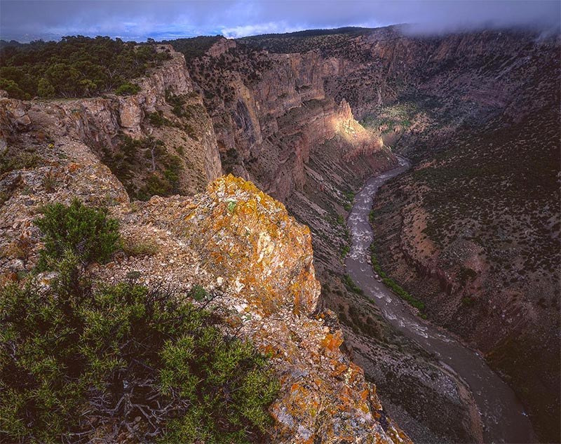
A spectacular view awaits you. Bakers Peak, Black Mountain and Mount Zirkel loom in the distance while far below the Yampa River tunnels through Cross Mountain Canyon. Observe the world famous cataracts with names such as Mammoth Falls, The Snake Pit and Pour Over City enticing thrill seekers to challenge the rapids.
Eagles and Peregrine Falcons may be seen soaring below in the canyon. Pinyon pine and juniper trees provide habitat for deer, elk, black bear and mountain lions.
Primitive overnight camping is allowed on adjacent BLM lands. There is no water or other amenities available here, so come prepared.
Godiva Rim
The Godiva Rim is a great way to get off the beaten path and enjoy all of Moffat County.
Located in the heart of Moffat County the Godiva Rim is an imposing anticline overlooking the entire Yampa Valley. Looking to the west you can see Browns Park, the Vermillion Basin, and Sand Wash surrounded by Douglas Mountain, Diamond Mountain and Cold Springs. Looking to the east you can see the area encompassed by Black Mountain, Bakers Peak, Medicine Bow Mountains, the Gore Range of the Continental Divide, and the White River wilderness.
On your way to Browns Park or Sand Wash it is a great side loop of about 25 miles, taking two hours round trip from Colorado Highway 318.
To access the Godiva Rim take U.S. Highway 40 to Maybell, turn west onto Colorado Highway 318. The road follows the Yampa River Valley 6 miles before crossing the river at Sunbeam. Continue on Colo. 318 another 7 miles across Peck Mesa and descend to the Little Snake River Valley. Moffat County Road 21 flanks the river on the east side. The road is paved to this point. Turn north onto C.R. 21, the road is gravel and well maintained, travel north 3 1/4 miles to BLM Road 2124, the Godiva Rim access road. Turn east on BLM Road 2124 and ascend the ridge. There are several lookouts to the west as you climb. The road is suitable for 2 wheel drive vehicles in good weather, but should not be attempted when wet conditions exist. The climb to the rim is 5 1/2 miles to the east. Upon reaching the crest of Godiva Rim the road turns north and follows the crest for 4 1/2 miles. There are many places to stop and view the valley to the east. The road drops off steeply on the north end to Moffat County Road 71. Turn west on Moffat County road #71 for 1 1/4 miles and return to C.R. 21. Turn back south and return to Colo. 318.
The views are spectacular at sunrise and sunset. For a special treat with the full moon rise over the Rockies you may even see Lady Godiva riding along the ridge, hair flying!
Plan ahead, be prepared, have plenty of water, snacks and fuel. Be aware of road conditions and always let someone know where you are going and when you plan to return. Charge those camera batteries and enjoy Moffat County’s hidden treasures day or night.
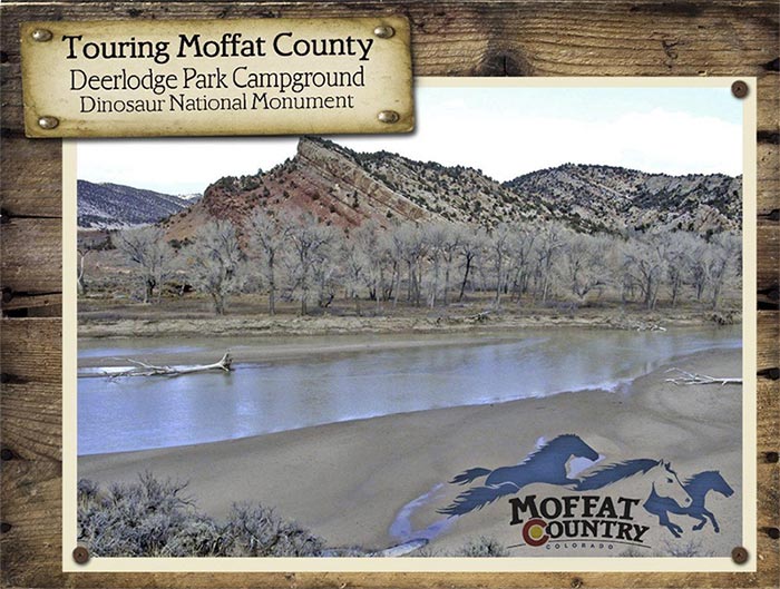
Deerlodge Park at Dinosaur National Monument
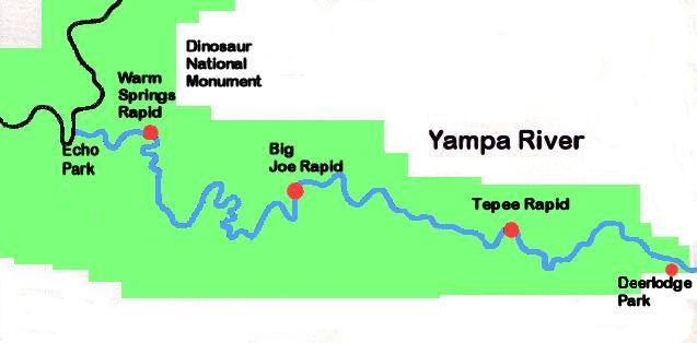
To get there: Go west from Craig on U.S. Highway 40 to mile marker 44. Take the Deerlodge Park road north and follow the paved road to the campground, a distance of 12 miles.
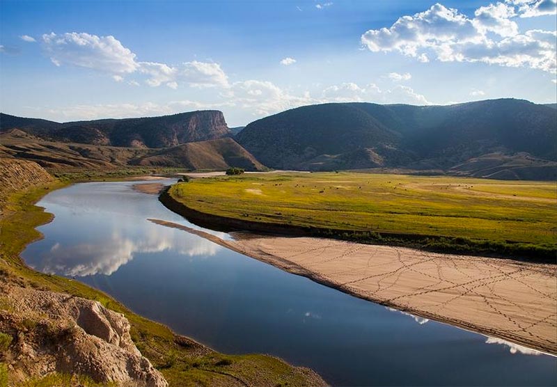
Deerlodge Park road winds down Twelvemile Gulch to the Yampa River. Spectacular Cross Mountain Canyon brings the Yampa River into Lily Park. A great warm water fishing hole awaits the angler here.
As you follow the road west through Lily Park, you will pass the confluence of the Yampa River and the Little Snake River, the largest tributary of the Yampa River.
There are many local attractions for the adventurer! Follow the paved road to its end, another quarter of a mile to the turnaround. From here an unmarked trail leads downriver to Disappointment Draw and the entrance to spectacular Yampa Canyon, distance 2 to 4 miles. Another great experience to enjoy at the turnaround is to scramble through the underbrush to the glimmering white beach sands of the Yampa River. Bring your swimsuits, sandals, towels and plenty of sunscreen. Build sand castles on the beach with your children or wade in the ankle deep water.
Wade across the slow moving water, and visit the Henry Shank Homestead. While you are on the north side of the river explore the Vale of Tears area, the view of Yampa Canyon is fantastic from this side.
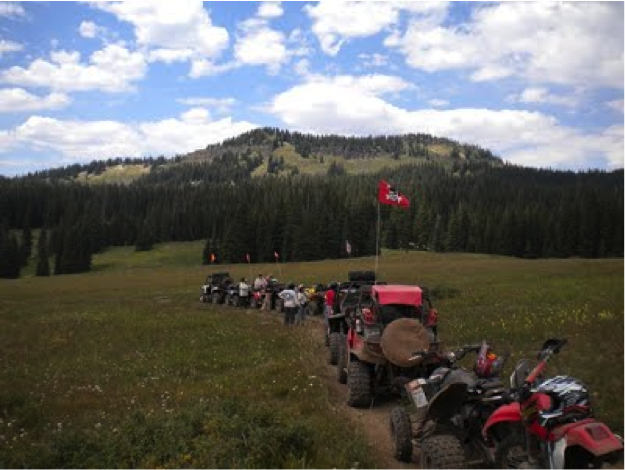
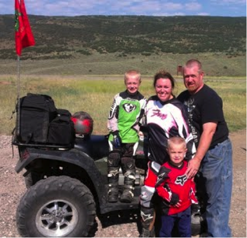
Bring your family and friends to experience THE WAGON WHEEL TRAILS with over 250 miles of OHV trails on the White River National Forest!
Rio Blanco County is a community that welcomes residents and visitors to enjoy great outdoor recreation activities such as camping, hunting, fishing, off-highway vehicle (OHV) riding, among others. To expand opportunities for outdoor recreation, the County started a project called the Wagon Wheel Trail System. The purpose of this project is to provide increased recreational opportunities through unique, satisfying, and sustainable OHV experiences in Rio Blanco County and Northwest Colorado. The long term goal for this project is to complete a trail system which will compliment US Forest Service and Bureau of Land Management travel plans, while providing connectivity to multiple counties, similar to the Paiute ATV Trail system in central Utah.
The Wagon Wheel Trail System currently has approximately 250 miles of roads and trails with varying levels of difficulty. The implementation of this trail system involves inter-jurisdictional cooperation between Rio Blanco County, the Towns of Meeker and Rangely, the Meeker and Rangely Chambers of Commerce, U.S. Forest Service, Bureau of Land Management, Colorado Parks and Wildlife, local and state enthusiasts. The first accomplishments of the project have included: creation of a database of existing OHV routes, posted route signs, creation of a marketing campaign, development of rules, regulations and enforcement. Two White River Rendezvous events have also been hosted in Meeker bringing some initial success to the project.
Sand Wash Basin
The Wild Horse: A Symbol of the West
Americans often associate the wild horse with independence and freedom, characteristics that, as a nation, Americans identify with and value. As a component of national identity, many believe the wild horse needs to be protected. Under the 1971 Wild Free-Roaming Horses and Burros Act, the BLM aims to manage, protect, and control wild horses and burros on public lands. It is because wild horses and burros are considered “living symbols of the historic and pioneer spirit of the West” and “they contribute to the diversity of life forms within the Nation and enrich the lives of the American people” that this Act was mandated. However, there is much controversy over the most effective way to manage wild horses.
Sandwash Basin
The Sandwash Basin Herd Management Area is the largest in the state. It covers 158,000 acres of public lands between Vermillion Bluffs and Sevenmile Ridge. This area’s history reaches back to prehistoric times and is a modern treasure chest for any adventurous geologist or archaeologist.
Sand Wash Basin is home to one of the few remaining herds of free-roaming wild mustangs in the United States. No one should miss the breathtaking sight of these rugged beauties running free. While the territory is expansive, most visitors can easily spot the grazing horses along the county roads that bisect the land.
Sand Wash Basin is a high desert area surrounded by ridges and mesas. Lookout Mountain on the northeast boundary is the highest point in the HMA at 8,120 feet, and the lowest point is where Sand Wash exits the HMA at an elevation of 5,800 feet. The Sand Wash Basin receives 7 to 12 inches of annual precipitation, and the climate is typical of the cold deserts of the Rocky Mountain Region, with warm summers and very cold winters. Vegetation types within the HMA include sagebrush/bunchgrass, saltbush, and pinyon-juniper woodlands.
No services are available in this area so be prepared with a full tank of gas, water, food, adequate clothing and gear for the elements. A 4 wheel drive, high clearance vehicle is recommended, especially in the spring, as this is mud season. A great set of binoculars and a telephoto wide-angle lens camera is also recommended.
Unique viewing opportunity
The horses of Sand Wash Basin come in a variety of colors and color patterns. Grey and sorrel are the most frequently seen colors, but visitors might also see palominos, blacks, red and blue roans, bays, buckskin, duns and paints.
The herd divides itself into bands — groups of two to 12 horses led by a mare and usually protected by one stallion. The lead mare will guide the band to watering holes, food and protection from the weather.
Spring is peak breeding season. Lone stallions try to gain control of a band of horses by fighting the band’s stallion or by encouraging females to leave and start their own band. Stallions also try to encourage mares to join their established band. All of these band dynamics makes for interesting horse viewing when the stallions snort, rear up and kick each other in battles for dominance.
Through the end of May, wild horses are also at the peak of their foaling season. This active period at Sand Wash Basin makes it an ideal time for a visit, especially before the temperature rises considerably during the summer, when daytime highs can reach 100 degrees or more.
The horses are curious but cautious. The best method for viewing the horses is to drive along the county roads in Sand Wash Basin. The roads, although in pretty good condition most of the year, are not maintained and can become difficult to drive and even impassable in wet weather. Vehicles also are allowed to drive on the two-track roads. Hiking is permitted anywhere within the BLM property.
Look for the horses along ridges and at the watering holes, which are noted on the area map by blue dots. Once you find a band of horses, avoid chasing them.
Instead, pick a spot and quietly watch them. Often, they will become curious about you and move toward you.
Sand Wash Basin has three driving areas: Loop A, Loop B and Sevenmile Ridge. Loop A can be an ideal location to find the horses with several dozen seen along County Road 126 and County Road 80. Sevenmile Ridge has two watering holes near County Road 75 on County Roads 66N and 66W and provides beautiful landscape views to the east.
In addition to the horses, Sand Wash Basin is also home to pronghorn antelope, sage grouse, coyotes, burrowing owls, elk and mule deer.
The entire basin is open to hiking but be prepared for backcountry exploration by carrying a map and compass. Motorcycle and all-terrain vehicle riding are permitted in the open areas in the southwest portion of the basin. Seasonal large and small game hunting is also permitted.
There is no cellphone reception or facilities at Sand Wash Basin so bring water, food and equipment in case of emergency. Although most of the roads are packed gravel and dirt, the clay soil can become extremely slippery in wet weather so be alert to changes in the weather. A four-wheel drive vehicle is recommended for any driving off the county roads. Tell someone your travel plans and when you anticipate arriving back in civilization.
OBSERVATION TIPS
Spring and Summer
The horses are distributed throughout Sandwash Basin. Horses can be seen on ridge tops during the warmest time of the day.
Winter Places
Roads are not maintained during the winter and can be difficult to travel.
Best Chance for Viewing
Travel County Road 67 to Sheepherder Springs. County Roads 48, 80, 52, 126 and 67 are good routes to follow when looking for horses.
Best Travel
Stay on marked roads for the safest viewing trip. Four-wheel drive is recommended but two-wheel drive vehicles can be used during summer months if it is dry. Roads can become impassable during wet weather.
History
In the mid-20th century, wild horses were harvested for commercial purposes. Velma Johnston, a secretary from Reno, Nev., was appalled by these activities. She led a grassroots campaign with school children to raise awareness about the harvesting. Her leadership led to the Wild Horse Annie Act in 1959, which prohibited the use of motorized vehicles to hunt wild horses and burros on public lands.
The population of wild horses continued to decline because of loss of habitat and elimination of the animals.
On Dec. 15, 1971, President Richard M. Nixon signed into law the Wild Free-Roaming Horses and Burros Act of 1971 providing further federal protection of the wild horses and burros on public lands.
Today, the BLM manages wild horses through the Wild Horse and Burro Program. In February 2013, the BLM estimated 40,605 wild horses and burros lived on 31.6 million acres, of which 26.9 million acres are BLM-managed lands in 10 western states.
Wild Mustangs
In 1971, wild horses and burros were found roaming across 53.8 million acres of Herd Areas (HAs), of which 42.4 million acres were under the BLM’s jurisdiction. Today the BLM manages wild horses and burros in subsets of these HAs, known as Herd Management Areas (HMAs) that comprise 31.6 million acres, of which 26.9 million acres are under BLM management.
The Sand Wash HMA is generally located 45 miles west of Craig, Colorado, in the Sand Wash Basin. The boundary of the HMA is fenced, except along State Highway 318, generally preventing wild horses from entering or leaving the HMA. There are no fences within the HMA, allowing horses to roam freely within the confines of the basin.
The horses within the HMA exhibit many different colors. Among the most common are grey and sorrel, although most colors and color patterns can be found, including buckskins, duns and paint. Genetic analysis indicates the highest similarity for the herd was to the Iberian derived Spanish breeds, followed by Gaited breeds, North American breeds and Arabian breeds.
The original population of horses with the HMA in 1971 was 65 head. The managed population range recommended is 163 to 363 horses. The existing horse population has been managed to the most current of these numbers through horse gathers in 1989, 1995, 1998, 2001 and 2005. The most census conducted shows a population of approximately 600 head.

Sand Wash Basin is located 45 miles west of Craig. Drive west on U.S. Highway 40 past the town of Maybell. Turn north on Colorado Highway 318 and drive approximately 15 miles. Turn right on CR67 to enter the Basin.

Contact Us
If you have questions or would like to check availability, call 970.926.0216 or complete the contact form.


